DISCOUNT :
Ref ALEG01 : The set of 12 large model Aviation Badges
Ref T28 : Sky-Watcher 114/1000
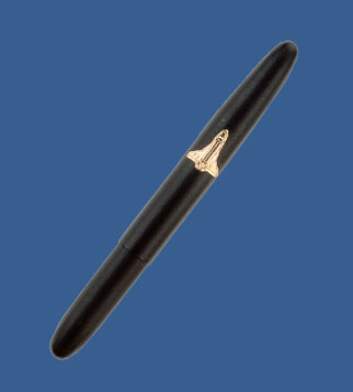
Ref SF2005 : Extra Black Ink Refill for the Fisher Space Pen
Ref L99.1 : HIGH LANDER Prominar visée à 45°
Ref LCN01 : The set of 2 caps
Ref D19 : ORBITAL STATIONS - 20 slides set
Ref ALD01 : The whole set of 16 sets of slides at a very interesting price
Our Picture Library
Retailers space
Our products
Photo Prints
Fisher Space Pen
Observation Instruments
Telescopes
Refractor Telescopes
Binoculars
Planetariums
Posters
NASA Caps
Slides
Message to E.T.
Wall Charts
Post Cards
Aviation Badges
Products listing
Our favourite links
L'astronome itinérant
*****************
Quick Find
Advanced Search
Newsletter
Unsubscribe
Information
Shipping & Returns
Privacy Notice
Contact Us
PageRank
Home
»
Photo Prints
»
Looking at Earth - Mountains - Hills - Snow - Ice
»
T01304
Ref T01304 : Lake Faguibine, Mali April 1991
Select in the form below the print format
you would like to order
DIMENSIONS
High Definition PRINT
BACKLIT*
40 x 40 cm
15.7 x 15.7 inches
16.80 €
95.00 €
50 x 50 cm
19.7 x 19.7 inches
26.00 €
125.00 €
60 x 60 cm
23.6 x 23.6 inches
37.00 €
32.00 €
150.00 €
80 x 80 cm
31.5 x 31.5 inches
59.00 €
49.00 €
195.00 €
100 x 100 cm
39.4 x 39.4 inches
85.00 €
79.00 €
300.00 €
*Backlit is a translucent matter to apply in front of a neon light
Thème :
Looking at Earth - Mountains - Hills - Snow - Ice
Description
:
The five lakes in this low-oblique photograph comprise the northernmost extent of the inland delta of the Niger River in central Mali—distinctive Faguibine, very angular and spear-shaped; Komango, immediately east of Lake Faguibine; elongated, north-south-oriented Tele; kidney-shaped Oro; and Fati. Each lake has a channel connecting it with the more extensive inland delta; very little open water can be seen in any of the lakes. Some speculation exists about the formation of these lakes, but the most plausible explanation focuses on wind erosion. Recognizing that the prevailing wind direction is from the northeast and that elevated ridges of apparently more resistant rock outcrops lie northeast of each lake, it seems reasonable that the wind blowing over these ridges produced troughs by the scouring effect on the leeward side of the ridges. In the recent past, these troughs (now called lakes) filled with water, probably when the Niger River flooded. This entire area is part of the southern Sahara Desert; therefore, rainfall amounts are generally less than 4 inches (10 centimeters) annually. This region of Africa is suffering from a prolonged drought that extended from the late 1970s through the mid-1990s. A small section of the Niger River is visible at the southeastern corner of the photograph.
Customers who bought this product also purchased
Ref S01239 : Globular cluster G1 in galaxy M31
Ref S01817 : This artist's rendering illustrates a Mars Sample Return mission under study at Jet Propulsion Laboratory (JPL) and the NASA Johnson Space Center (JSC)
Ref T01522 : Volcanoes, Kamchatka Peninsula, Russia December 1992
Ref SF1015 : A Retractable Chrome Plated Fisher Space Pen with Black Grip Design
Ref CM21 : The Paris area seen by satellite - (88 x 108 cm)
Ref D19 : ORBITAL STATIONS - 20 slides set
Ref C1003 : CELESTRON CELESTAR 8 TELESCOPE
Ref T105GP-D : Lunette NA 130SS 130/800
My account
Create an account
My Shopping Cart
Your Shopping Cart is Empty
Languages
Tell A Friend
Specials
Ref E341 : Aviation Badge
5.90 €
-
5.00 €
What's New?
Ref C504 : Lunette Celestron C6R Go-To
1,600.00 €
Currencies
US Dollar
Euro
Reviews
Write a review on this product!
Bestsellers
Ref SF1015 : A Retractable Chrome Plated Fisher Space Pen with Black Grip Design
52.00 €
-
38.00 €
Last update Tuesday 06 October, 2026